


The territory of Altyn-Emel National Park is home to the region's largest water bodies: the Ili River, the main artery of Zhetysu (Semirechye), and the Kapchagai Reservoir, the largest body of water in the Almaty region. Part of the Ili floodplain and the reservoir's shoreline form the park's southern border.
The park's entire water system belongs to the Ili River basin. The sources of local rivers and streams are located in the southern spurs of the Dzhungarian Alatau. Descending to the mountain base and foothills, they form a dense network of springs and small rivers.
Main Rivers: Tyul-Kuli, Uzynbulak, Taldysai, Kurumatai, Itmuryn, Zhamansai, Altyn-Emel, Dolanaly, Kaiyndy, and others.
All rivers are short and shallow. They are characterized by a "steep gradient" — a sharp drop in elevation from source to mouth (up to 700–900 meters). The river valleys are winding, with poorly defined floodplains and terraces. Streams are replenished by spring snowmelt, rain, and groundwater. This leads to a pronounced flood period in spring, while most rivers dry up during the summer.
In addition to permanent rivers, numerous seasonal (ephemeral) streams exist in the mountains. They have well-developed channels but remain dry for most of the year, activating only during the rainy season or snowmelt. Groundwater outlets and numerous springs play a vital role in their replenishment.
A special place in the park's hydrosystem is occupied by the Mynbulak Oasis, located in its central part at an altitude of 650–730 meters above sea level. Along an 8–10 km stretch, hundreds of springs emerge from the ground. These springs give rise to many streams, the largest of which — the Mynbulak stream — is 10 km long. During heavy flood periods, the waters of these streams reach the Ili River.
A ranger station is located in the Mynbulak Oasis on the way to the Singing Dune. This is a picturesque spot shaded by ancient willow trees where visitors are officially allowed to set up camp and stay overnight. The presence of permanent water sources makes this oasis an important watering hole for the park's wildlife, especially during high-water periods.
Ili River
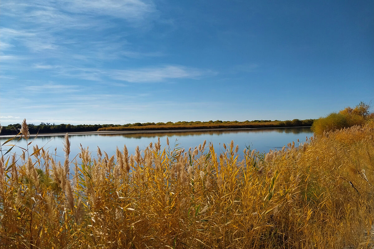
The Altyn-Emel National Park is located in the legendary historical and geographical region of Zhetysu (Seven Rivers). The park stretches along the right bank of the Ili River, which serves as its natural southern border.
The Ili is undeniably the primary river of the region. It originates in the Central Tien Shan (China) and flows into Lake Balkhash, desalinating its western part. The river’s name is ancient, presumably derived from the Mongolian word "ilansu" ("sparkling").
- Length: 1,439 km (815 km of which flow through the Almaty region).
- Water Volume: Ranks 3rd in Kazakhstan, following the Irtysh and Ural rivers.
- Scale: The basin covers 140,000 sq. km, with a delta area of 9,000 sq. km.
- The river freezes in late November (with ice up to 0.5 m thick); the ice break-up begins in April.
An ancient and beautiful legend is told about the Ili and Karatal rivers and Lake Balkhash.
The Legend of Lake Balkhash, Ili, and Karatal
The powerful sorcerer Balkhash had a daughter of breathtaking beauty named Ili. Her fame spread across the entire steppe, and wealthy beys and khans came from afar to seek her hand in marriage. However, none of them seemed worthy of her beauty. Finally, Balkhash decided to hold a great competition for the suitors.
"He who proves to be the wisest, the most agile, and the strongest shall have Ili as his wife!" the sorcerer proclaimed.
Among those who heard the news was a young man named Karatal. Though he was very poor, he possessed two magnificent horses and was known for his extraordinary skill, bravery, and strength. Karatal traveled to the sorcerer's palace to try his luck. At first, Balkhash refused to even speak with the poor youth, but Ili fell in love with him at first sight. She pleaded with her father to allow Karatal to compete.
Karatal emerged victorious, defeating the wealthy beys and khans in both wrestling and horse racing. Yet, Balkhash broke his word; he refused to accept a poor man as his son-in-law. Ili wept all day, but that night Karatal came to her in secret.
"If you love me, let us flee!" he whispered.
Ili joyfully agreed, and that very night they galloped away on Karatal's horses. When Balkhash discovered their escape, his voice thundered across the steppe, commanding them to stop. But Ili and Karatal refused to return, racing toward Karatal’s native village.
To stop them, the sorcerer transported himself ahead of the fugitives and transformed into a vast lake at the feet of their horses. Since then, the lake has borne his name — Balkhash. The sorcerer then turned Ili and Karatal into turbulent rivers, flowing into the lake from different sides*. For many centuries, they have surged and billowed, vainly trying to join their waters into one.
*Ili and Karatal are parallel rivers that flow into Lake Balkhash.
The territory of Altyn-Emel is part of the Upper Ili Water Management District. In addition to the Ili River itself, the key watercourses of this vast basin include:
- The Tekes River System: the Tekes, Narynkol, and Bayankol rivers (Raiymbek district).
- Rivers of the Dzhungarian Alatau: the Khorgos, Usek, and Borokhudzir rivers (southern slope of the range, Panfilov and Kerbulak districts).
- The Sharyn (Charyn) River Basin: the Sharyn and Karkara rivers (Panfilov, Kerbulak, and Raiymbek districts).
- The Great Almaty Canal Basin: the major rivers Shelek (Chilik), Turgen, Esik (Issyk), Talgar, and Kaskelen.
- The Ketmen Ridge: the Bolshoy (Great) and Maly (Little) Ketmensay streams (Uygur district).
To this day, there is no single consensus on which specific rivers gave the Zhetysu (Seven Rivers) region its name. Various sources, in addition to the Ili, mention the Karatal, Bien, Aksu, Lepsy, Baskan, Sarkand, Chu (Shu), Tentek, Koksu, and Ayaguz. Despite the scientific debates, it is this dense network of watercourses that creates the unique natural character of the national park.
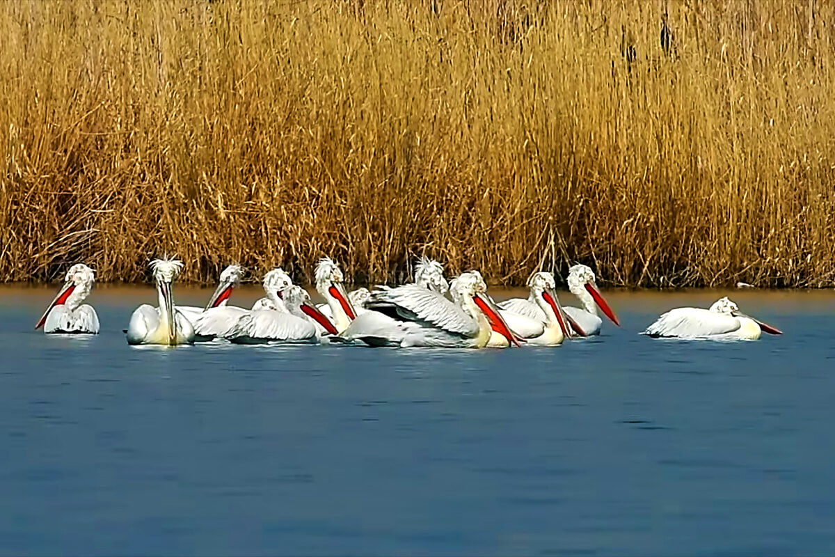
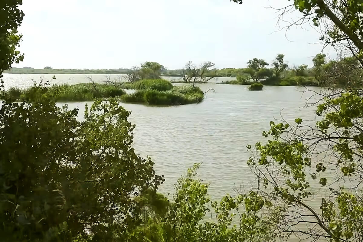
The freshwater ecosystem of the Ili River is the foundation of life in the national park. It supports unique biological diversity, including 28 fish species and numerous amphibians and birds. The river's avandelta (inner delta) is of particular value, as it hosts the richest variety of bird species in the region.
However, the ecosystem currently faces several serious environmental challenges.
At present, the river water is significantly polluted (with the primary impact originating from China). This creates an unfavorable environment for the life and development of all aquatic organisms.
Sharp fluctuations in water levels — both rises and falls — disrupt the stability of aquatic ecosystems. The drying up of shallow waters leads to a reduction or complete cessation of nesting for migratory bird species. The shallowing of floodplain lakes and coastal areas destroys traditional spawning grounds, inevitably leading to a decline in fish populations and, consequently, fish-eating birds.
During periods of human-induced (technogenic) floods, high flow velocities and abnormal water levels cause severe erosion of the Ili’s right bank, where relict tugai forests grow. These floods also have practical negative effects. The land turns into salt marshes (solonchaks) for extended periods, and inspection roads become impassable, hindering the patrolling of the territory.
A high content of suspended particles in the river water leads to intensive siltation of the Ili riverbed and the Kapchagay Reservoir. This significantly worsens the conditions for fish reproduction, posing a threat to the future of the entire reservoir population.
Kapchagai Reservoir
The Kapchagai Reservoir is the largest man-made body of water in the Almaty region and the second largest in Kazakhstan by surface area (following the Bukhtarma Reservoir on the Irtysh River). It was created between 1965 and 1970 following the construction of the Kapchagay Hydroelectric Power Plant dam.
The primary goal of the project was to regulate the flow of the Ili River: due to low water levels, it was extremely difficult to use its resources for the irrigation of the valley's agricultural lands.
Dimensions of the Reservoir:
- Maximum length: 180 km
- Maximum width: 22 km
- Maximum depth: 45 m
The filling of the reservoir significantly altered the region's natural appearance. A unique complex of wetlands formed in the Ili River's inner delta (avandelta). These new ecosystems provided ideal nesting conditions for numerous bird species, increasing the biodiversity of the region.
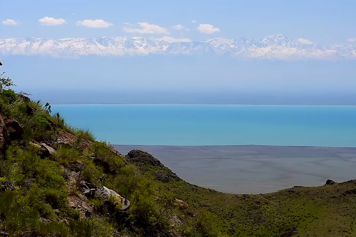
The southern boundary of the Altyn-Emel National Park runs directly along the reservoir’s shoreline. Here, nature creates a striking contrast: the westernmost edge of the Dzhungarian Alatau — the Sholak Mountains — meets the vast waters of the Kapchagai.
ATTENTION: Fishing and beach recreation on the banks of the Ili River and the Kapchagai Reservoir within the Altyn-Emel National Park are STRICTLY PROHIBITED!
Important Information: